
Feature
Using Lidar to Measure the Ozone Layer
South American scientists are using lidar technology to measure stratospheric ozone, water vapor and aerosols in Argentine Patagonia. Their work is helping to monitor global climate change, and has led to the development of a method for alerting local populations to the presence of the ozone hole.
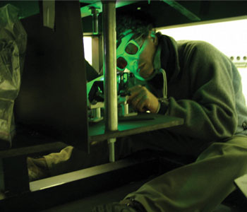
SOLAR team member aligning mirrors of the lidar’s optical bench, which send the laser beam into the atmosphere.
The ozone hole is an area over the Antarctic stratosphere in which ozone levels have been depleted to more than 60 percent of what they were before 1975. The hole occurs in the period known as the austral spring—from September through early December—when strong, westerly winds blow around the contintent and isolate polar air masses from mid-latitudes.
As this “polar vortex” passes over the region, it causes an increase in solar radiation that reaches the Earth’s surface. Thus, the ozone hole is thought to play an important role in global climate change. It also places the inhabitants of affected areas at increased risk for contracting skin cancer and certain ocular diseases.
Although there is a lot of science documenting the thinning of the ozone layer and its effects on human health, there are few high-latitude locations from which researchers can make long-term measurements to monitor the problem. Antarctica is, of course, ideal in terms of its proximity to the hole, but its remote location makes it a difficult choice.
Another option is Southern Argentina. Much of this region is located beyond parallel 51, which reaches the edge of the ozone hole during the austral spring. Our research group, from the Lidar Division of the Laser and Applications Research Center at CEILAP in Buenos Aires (34° 33'S, 58° 30'W, 20 m above sea level), conducts our measurements from the town of Río Gallegos (51° 36'S, 69° 19'W, 15 m ASL), the capital of the Santa Cruz province of Argentina.
In addition to its location at one of the best possible latitudes, Río Gallegos offers the advantage of clear night skies—which facilitates atmospheric studies that use a wide range of remote sensing techniques.
Log in or become a member to view the full text of this article.
This article may be available for purchase via the search at Optica Publishing Group.
Optica Members get the full text of Optics & Photonics News, plus a variety of other member benefits.